Home
Feb 6, 2012 by Thijs_
Map coordinates in reports and journals
This article is a generic tip and also a reference for myself. Almost all reports on this website contain map coordinates in a 6-digit form. They are used to locate enemies, line of departures and the whereabouts of neighbouring units. Luckily thanks to a website it is possible to translate these 6-digit coordinates to modern day GPS coordinates. This excellent website can be found here.
Next to the 6-digit coordinates two variables are needed. One is the grid name and the other is the sub grid. As an example i take the After Action Report for the 331st of March 1945 which can be found here. On page three at the end of the page it says:
Two platoons led by Capt. Oliver ran into stiff resistance near 295885.
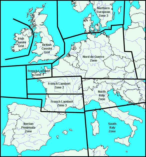
Say we want to know the exact location we need to find out the grid and the sub grid. The AAR tells us that they are fighting around Neuss. That corresponds to the grid Nord de Guerre which can be seen below:
Within this grid you then have to select the subgrid:
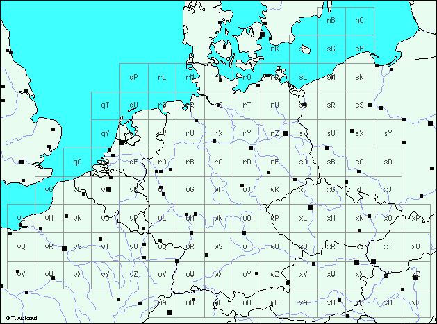
You can look up the location of Neuss on Google Maps and in this case the sub grid is wF. You then fill in wF295885 as coordinate and this resolves to a coordinate at the edge of the Rhine river. You can do this with all coordinates just figure out the grid and the sub grid. That is all there is to it!
Next to the 6-digit coordinates two variables are needed. One is the grid name and the other is the sub grid. As an example i take the After Action Report for the 331st of March 1945 which can be found here. On page three at the end of the page it says:
Two platoons led by Capt. Oliver ran into stiff resistance near 295885.
Say we want to know the exact location we need to find out the grid and the sub grid. The AAR tells us that they are fighting around Neuss. That corresponds to the grid Nord de Guerre which can be seen below:
Within this grid you then have to select the subgrid:
You can look up the location of Neuss on Google Maps and in this case the sub grid is wF. You then fill in wF295885 as coordinate and this resolves to a coordinate at the edge of the Rhine river. You can do this with all coordinates just figure out the grid and the sub grid. That is all there is to it!

Next page: Units